
Active Travel Route - Montgarrie to Alford
Consultation has concluded and path has been constructed and is in use.
Construction due to begin 27th January 2025.
Follow up survey has now closed. You can read about the feedback here: Active Travel Route - Montgarrie to Alford | We Asked, You Said, We Will | Engage Aberdeenshire
Aberdeenshire Council are working with the community to provide a safe and reliable active travel connection between Alford and Montgarrie. Towards the end of 2023, we engaged with the local community for feedback on our proposed route. Around 64% of respondents expressed support for our suggested route with 74% stating that they would use the route for leisure or travel. You can view the initial survey results under recent documents. Following the outcome of our engagement, we have continued to work on our original proposal with the aim of designing a route which is accessible for all users but also in-keeping with the natural environment.
The chosen route was designed to find a balance between using the most direct route and utilising the existing paths whilst causing the least disruption to the environment and making the most of the natural features. The follow up survey focused on gathering feedback on the finer details of the updated route to ensure the finalised path is accessible for everyone. We are also asked for your ideas and feedback to understand how the community can get the best use out of the path. Following a review of your feedback, we will make any final amendments to begin construction.
Path Location
The ‘Updated Path Design’ document shows the full route and detailed segments of the route. This design has been further developed following initial community consultation whereby the majority of the community expressed support for the proposed route.
You can also view the 'Feasibility study' which explains in more detail why this route was chosen as the preferred option and the initial 'Concept Design' which was put forward to the community towards the end of 2023.
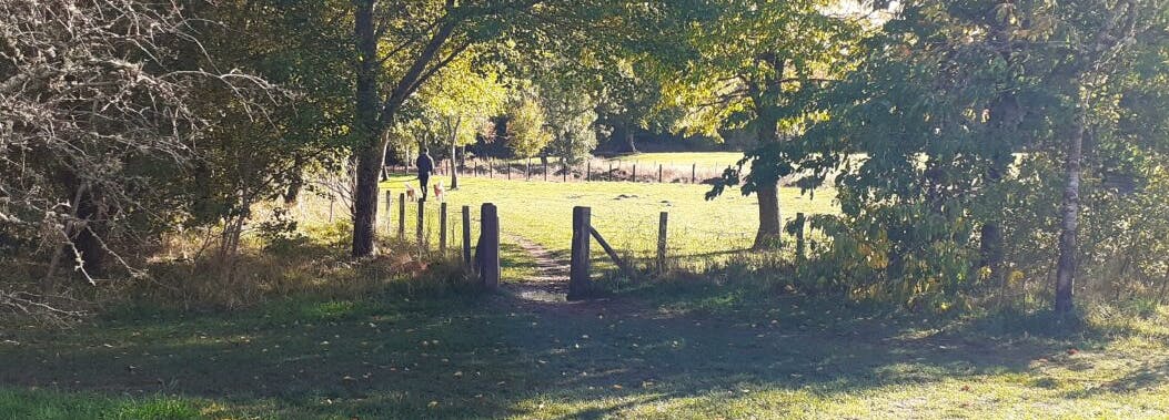
The chosen route follows existing paths through Haughton country path which will be upgraded to a 2 m wide path to create a more accessible route for all users and mobility. The route will start/ end at Montgarrie Bridge and starts/ ends at the entrance to Haughton Country Park.
This route follows a slightly less direct route through Haughton Country Park than another option. This would make it 46 m longer in length but would have less of an ecological impact on trees, wildlife and habitats. Another option looked at formalising an existing core path along the River Don but this route can be subject to flooding and could damage the path.
Surface Material
The surface that will be used will be sub-base binded with granite dust. See document 'Surface materials' for more details.
Lighting
No street lighting will be included in this design due to the cost associated with this. This is also in line with council policy of rural paths. Due to the materials being used for the path construction and extent of tree cover, the installation of solar lights or studs would not be appropriate. Additionally to this, any source of light provided would negatively impact the natural environment.
